Volume III, Issue I Available for Pre-order Now


EACH YEAR, I EXAMINE HUNDREDS OF MAPS AND HAVE DEVELOPED A KIND OF SIXTH SENSE ABOUT THEM. In an instant, I can discern which were drawn out of colonial greed and which function as artifacts of a culture’s broader worldview. Colonial maps, in particular, carry a distinct feeling. They suggest that the author is preoccupied with only three questions: Where are the resources? Is this place viable for my imagination? And will Indigenous communities pose a problem? Even the color palettes used in these maps are devoid of warmth and nuance. One of the clearest historical expressions of this colonial cartographic logic can be found in the work of nineteenth-century American mapmakers.
Take the cartographer Anthony Finley for example, whose American atlases were widely circulated in the early nineteenth century. Their popularity extended from classrooms and libraries to emerging industries such as railroads and urban planning. As a result, Finley’s work played a significant role in shaping the American imagination of his era. This point is essential, because the tone of his maps conjure a particular attitude toward indigeneity and presents America as a blank canvas with no history deemed worthy of preservation.
In Finley’s 1826 Map of the United States, territories with colonial settlements are highlighted in vibrant colors, conveying a sense of promise and safety.[1] By contrast, uncolonized territories are rendered in black and white, reduced to mere markers of location and treated as landscapes “waiting to be claimed.” When I encounter these erasures, I clench my jaw. My shoulders tighten, and I feel a strange sense of time travel as I imagine what Indigenous people of that moment may have felt. I imagine that they recognized the colonizers as spiritually sick and mentally blind. How else could colonizers arrive in a land they had no desire to steward and see it only as material for constructing their disconnected world? That visceral response is not incidental; it is the result of a trained way of seeing.
This form of cartographic discernment is not the product of chance or prejudice; it is a muscle developed through the study of hundreds of maps across cultures and historical periods. Consistently, the body remains in communication with the ideologies of the maps’ authors. Their greed, violence, and priorities are perceptible. Even map keys and legends disclose what matters most to the cartographer and to the intended audience. Over time, this sustained attentiveness has transformed analysis into a form of intimate familiarity.
As strange as it may sound, I take a certain pleasure refuting these decrepit colonial maps. The details of their delusions remain compelling. For example, a colonial cartographer who believes erasure and imperialism to be divinely ordained often employs gold-toned palettes and carefully marks the locations of Christian missions, as seen in the 1862 Map of Sierra Leone produced by the Church Missionary Society and authored by Jackson and Halliday Heely in London.[2] By contrast, colonialists who are more forthright about their greed and pillaging—like Finley—construct a different visual filter, one rooted in “freedom” and “ungovernability.” This aesthetic renders Manifest Destiny’s core assumption visible: land imagined as empty and awaiting claim by white settlers asserting a supposed divine right to continental expansion. It is against this cartographic tradition—and its enduring consequences—that Black cartographic discernment emerges as both refusal and repair.
This essay examines how Black cartographic discernment functions as both a survival technology and a land-justice practice. By analyzing the work of historical counter-cartographers such as Victor and Alma Green and Louise E. Jefferson, alongside my own embodied desert fire practice, and the Leyline Almanac’s liberation mapping, I demonstrate how alternative modes of reading maps enable spatial sovereignty. These practices do not merely correct colonial lies; they build infrastructure that allows Black communities to navigate on their own terms and to deepen relationships with land that colonial cartography sought to deny.
Victor Hugo Green began working as a postal carrier in New Jersey in 1913. I imagine this work granted him a broader understanding of Black people in the United States’ spatial condition. By 1936, he and his wife Alma published the first Negro Motorist Green Book[3], a living map that depicted safe places for Black people seeking distance from “the weather” of white supremacy in America.[4]
These maps and guidebooks were so necessary that they were published every year until 1967. Of the 89 counties along Route 66, 44 were Sundown Towns. Travelers navigated this reality by packing extra food (in anticipation of inaccessible restaurants), bed sheets to create partitions for restroom breaks, and extra medication in case of emergency. The lawful institution of Sundown Towns meant that if Black travelers were caught in white towns after sunset, they risked, at a minimum, imprisonment.
Despite this daunting reality, Black travelers, with the Green Book in hand, still ventured to places such as the Grand Canyon, Yellowstone, and Yosemite National Parks, eager to explore the nation. They understood that the terrors of white supremacy primarily caged those who upheld it; the land itself posed no inherent threat. Understanding these experiences of navigation and survival also requires situating them against the longer history of how maps have structured power and perception.
Colonial cartographies were not just time capsules of a distant moment, they trained the outlook of generations worldwide. They shaped spatial understanding and reinforced a hierarchical worldview under the guise of education and spiritual salvation. These practices form the foundation of the maps we use today. People learned to navigate the world with a sense of commodified urgency that reduces living landscapes to inanimate relationships. Societies have been socialized to prioritize boundaries over flow, extraction over reciprocity, and ownership over relationships.
This understanding of maps as relationship-building technologies has historical precedent in Black counter-cartographic work. Louise E. Jefferson was a visual storyteller during the Harlem Renaissance, but to me, she embodies the essence of what it means to be a Black person working in the field of counter-cartography. Her maps of Africa, the Polynesian Islands, and the United States reshaped the spatial narrative of the Black Diaspora in the 1940s. From the start, she understood the importance of worldview and of writing ourselves into the world.[5]
Jefferson’s work continues to inspire today, shaping how we share and teach these narratives in contemporary spaces. In 2025, I made a video about Jefferson’s 1946 Friendship Map of Africa, explaining my appreciation for her deep care for Diasporic worldviews, and it went viral across social media platforms. Teachers continue to reach out to me, sharing how they plan to incorporate her maps into their curricula and expressing excitement about shaping the imaginations of the next generation. This is why we must remember our own stories and share what excites us.
Jefferson’s maps seamlessly marry accessibility and sophistication. She used bright colors, bold typography, and pictorial elements that strengthened pattern recognition across all ages. Unlike the cold, clinical aesthetic of colonial atlases, her pictorial style invites viewers into a relationship with the geography. Her 1946 Americans of Negro Lineage map did not merely list Black achievers, it positioned them within a spatial narrative of belonging and contribution.[5] Where Finley’s maps erased Indigenous and Black presence, Jefferson’s maps centered Black geographic significance the United States and Canada to honor the Underground Railroad networks.
The maps created by Jefferson detail the notable contributions made by Black communities in the United States. She showed how life and achievement congregate around the Mississippi River and extend along the Missouri and Ohio Rivers. She marked every Black college and university, decorated her map titles with Diasporic masks and architecture as reminders of this continuum of Africanity, and created banners honoring Black inventors, musicians, laborers, and enslaved peoples whose presence has often been minimized. She also included brief notes describing each region’s contributions to Black geographic presence.
Through these offerings, the desert fire becomes not only a physical ritual but also a lesson in reciprocal presence, teaching us to engage with the land intentionally.
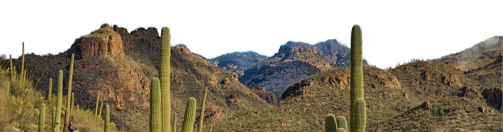
Counter-cartography is not limited to paper maps. It exists in embodied practices that resist colonial frameworks for relating to land. My monthly desert fire ceremonies function as living cartography, navigation systems that both predate and oppose the extractive logic embedded in Finley’s atlases. Through these practices, the land itself teaches, and human presence becomes an active participant in mapping.
Each month, I travel to my Sonoran Desert campsite at an off-grid location. The trip has become a ritual: loading the car with my telescope, racing the sun, and slowly rolling off-road along a bumpy path, fully absorbed in the silence of the landscape. Although I have been camping here for nearly five years, I still survey the area as if it is new, scanning for new neighbors and shifts in the terrain and searching for fallen saguaro ribs, mesquite, and even jumping cholla, or Sonoran bones, transformed into wood for my fire.
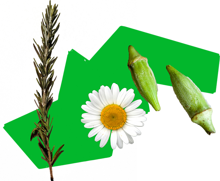
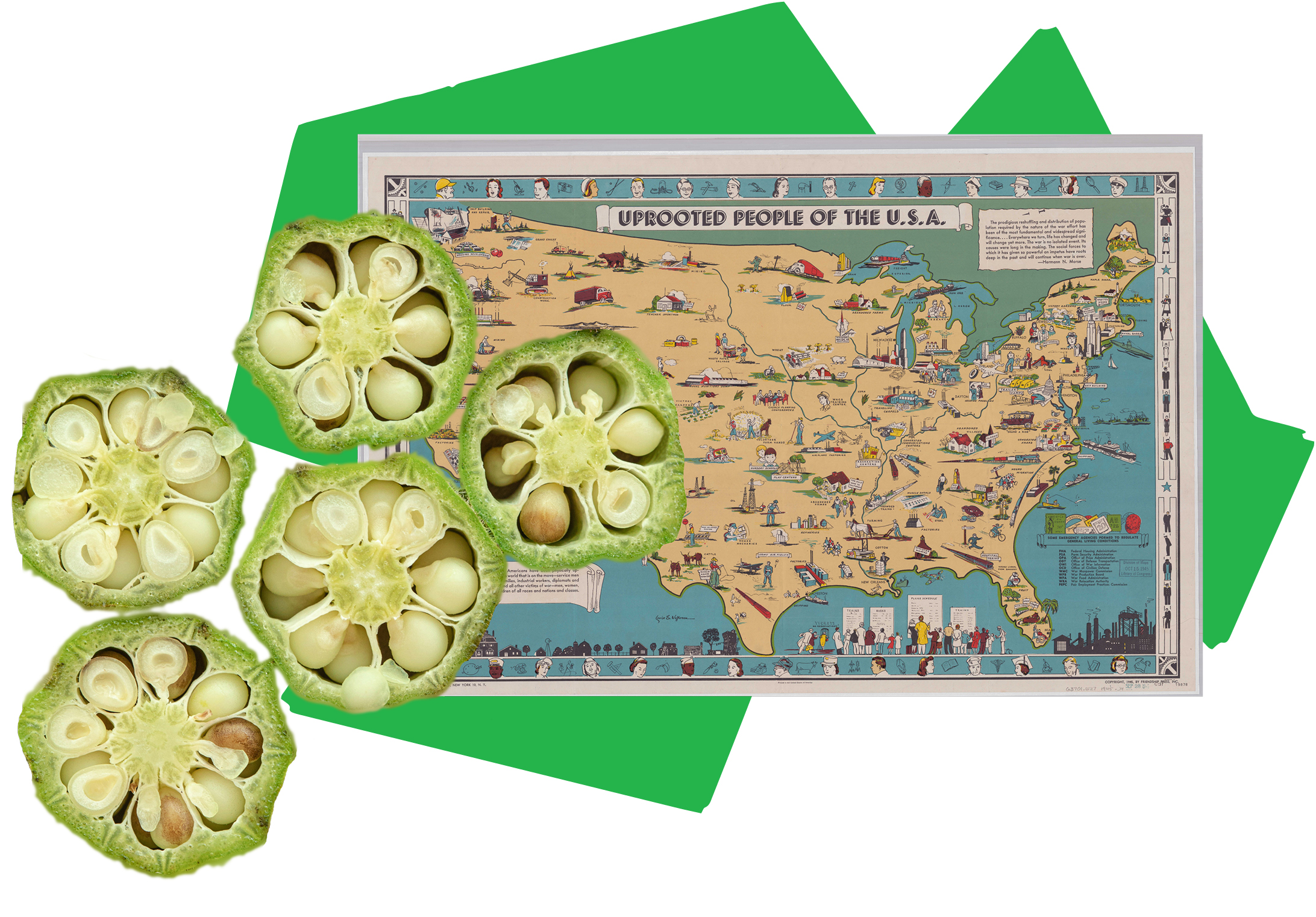
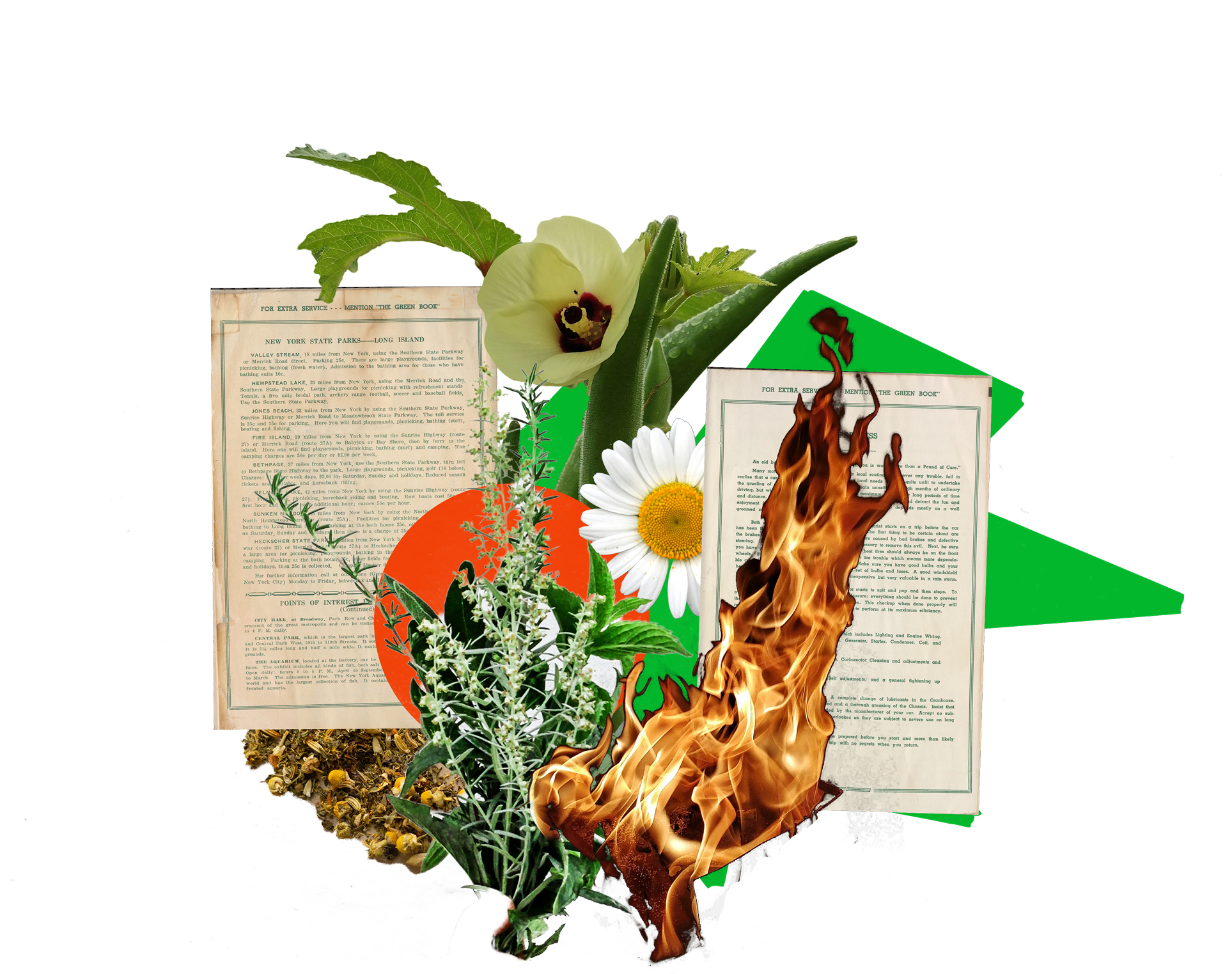
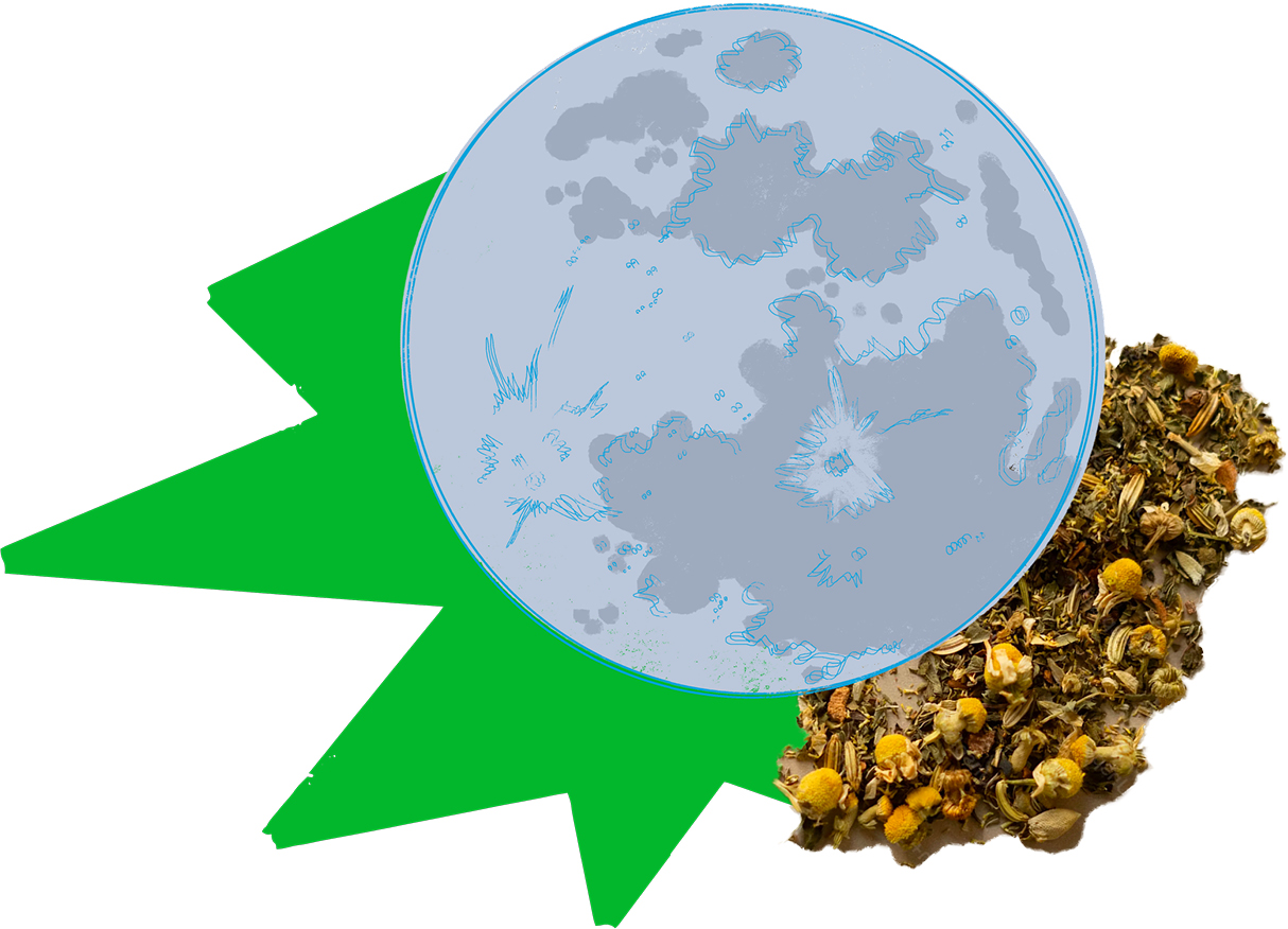
I have a saying: “Never eat from a fire you haven’t fed.” Before I strike my match, I offer blue cornmeal (a staple among the Tohono O’odham in Tucson), Mayan copal (a tree resin that has traveled this land for generations), tobacco and cotton (bridge crops significant to both Black and Indigenous Americans), okra, chamomile, and rosemary (favorites from my ancestry and personal plant allies). In this way, I replace superstition with a consistent relationship. The last three offerings: okra, chamomile, and rosemary, may change depending on what medicine I have been cultivating in the prior month. They could become a bouquet of flowers, a letter, or a plant that has been appearing in my dreams. Through these offerings, the desert fire becomes not only a physical ritual but also a lesson in reciprocal presence, teaching us to engage with the land intentionally.
Each time I return to my fire pit, I enter into communion with this place through elemental transformation. I have learned how fire makes this wisdom tangible. Each type of wood burns not only at its own pace but also in its own way. Mesquite produces quick, hot flames, ideal for cooking or warding off the cold. Jumping cholla whistles as the flames move through its holes, marking moments of unforeseen illumination. Saguaro ribs provide thick smoke, a distinct scent, and a sustained heat that’s perfect for fire dancing or creating torches against the dark sky.
When I say, “Never eat from a fire you haven’t fed,” it is an invitation to reciprocity: to recognize what the land offers and to contribute something in return. The time we invest in nurturing the flame directly shapes the nourishment we will receive. This is both physical and spiritual cartography. We cannot rely on colonial maps to guide us, since they were concerned only with resources to fuel their extractive agendas. We did not build those maps, so how could they keep us warm?
Perhaps the most enticing aspect of this experience is how fire shapes the darkness. While modern lighting attempts to erase the night completely, desert fire practices offer a form of wisdom that teaches us to navigate the darkness rather than be extinguished by it. We learn to live within a contrast that we conjure and to tend the field where they touch. In this way, we map territory through the dance of light and dark, strengthening night vision that sees the landscapes differently rather than less.
Fire reminds us of an ancient, embodied form of navigation that teaches through the skin rather than through sight. The concentric rings of heat create a gradient of experience: the viciously hot inner circle, the middle region where the heat is most tolerable, and the outer edges where the coolness of the desert remains untouched. This thermal cartography cultivates temporal awareness within the body itself. Colonial mapping often flattens human experience into resource extraction or religious grandeur, or conundrums of the mind, with little relation to lived experience. Even in colonial botanical journals, when authors document how Indigenous peoples interact with a plant, they reduce it to physical description while ignoring its layered relationships to life cycles and the soil that nurtures it. They compress life and human connection to it into something to be organized or dominated.
This spiritual and bodily awareness of time contrasts sharply with the mechanical clock, which measures time in terms of productivity. It prioritizes efficiency and speed, and it dictates when humans receive the illusion of “rest” so they can return to their work with a little more joy. My desert fire practice reveals what happens when we reconnect with the elemental nature of time itself. Here, duration is not an abstract concept but a tangible experience, measured by the consumption of wood, the heat generated, and the new landscapes revealed.

Maps are not neutral representations of reality. They never have been. They are artifacts and technologies that structure perception through specific filters. The fire-centered counter-cartography of desert camping creates possibilities fundamentally different from those conveyed by a GPS or paper map. Whereas conventional cartography reduces space to standardized symbols on a page, fire tending creates a direct temporal-spatial relationship that engages all the senses. This practice is not merely about mapping physical landscapes; it also weaves energetic territories. It is where human presence encounters the land in its natural state, where light meets shadow, and where heat touches and transforms the cold. Through these practices, desert fire becomes a form of counter-cartography, mapping beyond the land, through human perception, relationality, and presence in ways that conventional maps cannot capture.
Counter-cartographers such as Louise E. Jefferson and Victor and Alma Green have inspired me to consider the connections revealed through curiosity, collaboration, and the courage to archive uncomfortable truths. The most reliable historical accounts are those that are dynamic and incorporate multiple perspectives.
Inspired by these counter-cartographers, I applied the same attentiveness to patterns of liberation in the second edition of my Leyline Almanac, a spiritual geography planner that maps global liberation dates through zodiac seasons.[6] I spent several weeks revealing patterns that colonial calendars obscure. For instance, Samoans gained their independence during Capricorn season. They mandated that 80 percent of their land could never be sold and could only be passed through Matais (family chiefs). In this way, they preserved their sovereignty and legacy, embodying Capricorn energy. Similarly, twenty-five nations around the globe gained their independence during Leo season. The courage required to break free from colonialism and imperialism is particularly abundant during the months of July and August.
Zodiac patterns appear across regions and histories, from Leo nations to those gaining independence during Aries season, each reflecting the energy of new beginnings in distinct ways. Take Ghana, for example, which gained independence on March 6, 1957, at the threshold of Aries season. Ghana was the first sub-Saharan African nation to break free from colonial rule, and its pioneering spirit reflects the initiating fire that Aries represents. Syria, Tunisia, and several other nations also claimed independence during this season of new beginnings, each embodying the cardinal fire energy that charts new territory and refuses to wait for permission.
Examining these patterns invites reflection on the deeper dynamics of sovereignty: how liberation movements unfold and how the legacies of imperialism continue to shape nations. By mapping liberation dates, I invite people to tune into the cartography of change and sovereignty. We expand our understanding beyond the imperialist scope by examining revolution through zodiac seasons, or energetic time capsules during which these liberation movements occur and considering why. Sometimes, a nation’s psychic wounds from imperialism run so deep that its liberation efforts unintentionally reproduce the colonial structures imposed on it. There is a lot of wisdom in this: eradicating the force of imperialism requires more than changing flags.
Spatial decolonization creates opportunities to update our approach to the Earth itself. The wounds of colonial cartography have promoted a streamlined worldview, one that is extractive and diluted. The work of today requires us to engage with pre-colonial timelines and build from that perspective, informed by the land’s unique twists and turns. These territories are not abstract; they are dynamic expressions of life that respond to our collaboration. By remembering how to relate to a place through reciprocity rather than extraction, we open pathways toward regenerative futures that colonial spatial programming made difficult to imagine.
Teaching cartographic discernment begins with simple questions: Whose perspective does this map center? What has been left out? What does the visual language reveal about the mapmaker’s relationship to that location? Just as Jefferson created educational tools that empowered Black communities to see themselves in geography, contemporary counter-cartographers can develop resources that help young people recognize spatial violence and imagine alternatives. This constitutes survival literacy for navigating a world still organized by colonial spatial logic.
Cartographic discernment is a form of land justice because it determines whose memory, relationships, and imagination guide our understanding of the world. Malcolm X understood this when he declared, “Land is the basis of all independence. Land is the basis of freedom, justice, and equality.”[7] Without control over how we relate to land and how we map our presence upon it, self-determination is impossible. The Green Book, Jefferson’s maps, my desert fire practice, and the Leyline Almanac’s liberation calendars all participate in a lineage of Black spatial sovereignty that refuses colonial frameworks for understanding territory.
My desert fire practice exemplifies land justice through reciprocity-based harvesting and offerings that honor the territory’s memory rather than extract from it. The Green Book enabled land justice by empowering Black travelers to distinguish between the inorganic institutions of the United States and the vast, varied character of Turtle Island. These routes allowed Black people to navigate hostile American geography, acting as a cloak that created networks of safety within white-controlled spaces and resisted spatial confinement. Mapping safe territories across America over thirty years generated a hidden language, a code written in the margins.
Fannie Lou Hamer understood this principle when she founded the Freedom Farm Cooperative in 1969, declaring, “If you have 400 quarts of greens and gumbo soup canned for the winter, nobody can push you around or tell you what to say or do.”[8] The 680-acre Mississippi cooperative, where Black families collectively owned land and grew their own food, represented economic independence from white-controlled food systems. Both the Green Book and Freedom Farm practiced the same survival technology: creating Black spatial sovereignty through direct relationships with the land. Visual sovereignty operates through similar principles.
Jefferson’s pictorial maps practiced land justice by detailing the notable contributions of each African region, directly challenging assumptions about the geographic presence of Black people in history.
This lineage of Black cartographic discernment addresses ongoing spatial violence. Between 1910 and 2022, Black Americans lost approximately 90 percent of their land through violent dispossession, discriminatory lending, partition sales, and eminent domain. Mapping independence dates through zodiac seasons reveals patterns of territorial reclamation across the globe. Liberation is not only about shifting political power but also about removing the colonial lens from territory itself, freeing all inhabitants from the objectification and reduction of land to mere resources. The Leyline Almanac organizes these reclamation patterns by zodiac season so that pattern recognition runs parallel to growing cosmic interest. The cosmic timing of land justice movements aligns with the energetic signature of each zodiac season, providing celestial evidence of independence movements harmonizing with larger temporal rhythms.
Counter-cartographic practice has made me multilingual in understanding how colonial documents shape the outlook of entire generations. Learning to read maps differently empowered me to reclaim the reins of my future, reshaping and re-membering connections beyond the frameworks of dominating capitalism. I invite readers to expand their worldview by exploring Native Land Digital, a website where the stories of land and waters are carried by those who maintain ancestral relationships with them.[9] Examine the land you inhabit with fresh eyes, consider the hidden or marginalized stories embedded there, and reflect on how these stories have shaped your life and can inform your path forward. Counter-cartography is how we bust through the seams of what we are socialized to center and preserve a method of relating that is both ancient and futuristic.
The future of Black cartographic discernment depends on cultivating new generations of spatial thinkers who understand that maps are never neutral. Young Black cartographers, geographers, and artists must learn to read the ideologies embedded in official representations while creating their own counter-narratives. This work is not optional. It is survival literacy for navigating a world still organized by colonial spatial logic. When we teach children to ask whose perspective a map centers, what is left out, and what the visual language reveals about the mapmaker’s relationship to a location, we equip them with tools to imagine and build different spatial futures. Every map we question, every spatial narrative we refuse, and every relationship we build with land outside colonial logic becomes infrastructure. The coordinates are already written in fire smoke, Green Book margins, Jefferson’s pictorial languages, and zodiac patterns of liberation. We are not waiting for permission to navigate differently. We are already moving.